Driving guide
Barstow to Victorville route guide
A four-page reference combining mileage, photographs, and historical context for a well-known desert section of the highway.
PDF · 4 pages
Download the four-page guideAn independent historical reference.

Downloadable reference · route research
Collect printable route notes, driving references, and self-guided material for exploring the historic highway corridor and its surrounding desert communities.
These documents are historical reference material. Details, routes, access conditions, and services may change; verify current information before traveling.
About these resources
The downloadable guides bring together mileage, photographs, historical notes, landmarks, and route-planning prompts connected with the desert highway landscape.
Use them as starting points for independent research rather than as current operational instructions. A printed guide can help place surviving signs, buildings, roads, and landscape features within a wider story of mobility.
Download library
Open the resource that best matches the scale of your research or planned reading. PDF documents may be saved for offline use; image maps provide a quick visual overview.
Driving guide
A four-page reference combining mileage, photographs, and historical context for a well-known desert section of the highway.
PDF · 4 pages
Download the four-page guideLarge type
A shorter version of the route material, prepared in a larger format for easier reading and quick consultation.
PDF · 2 pages
Download the condensed guideRegional reference
A broad-area planning document introducing places and activities within reach of the desert route corridor.
PDF · regional guide
Download the regional guideSelf-guided tour
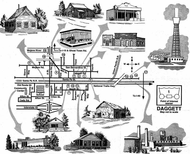
Route notes for reading the historic settlement landscape and identifying points of interest along a self-guided drive.
PDF · tour notes
Download tour pointsMap reference
A downloadable map supporting the accompanying self-guided route material.
JPG · map image
Download the tour map
Using the archive
Historic route documents are most useful when paired with careful observation. Compare printed descriptions with the landscape, remaining structures, archival photographs, and local interpretation you encounter.
Because conditions and access can change, treat every download as dated background material and confirm current arrangements independently.
Explore exhibit themesA simple research method
01
Start with the short guide for orientation, or use the longer route document when studying a specific corridor.
02
Note signs, buildings, road alignments, and landscape features that connect the printed material with surviving places.
03
Separate historical information from current travel details, and verify anything that affects access or safety.
Questions about this independent reference?
info@routemuseumstory.en-html.org